Περιγραφή Προϊόντος:
Κύρια Σημεία
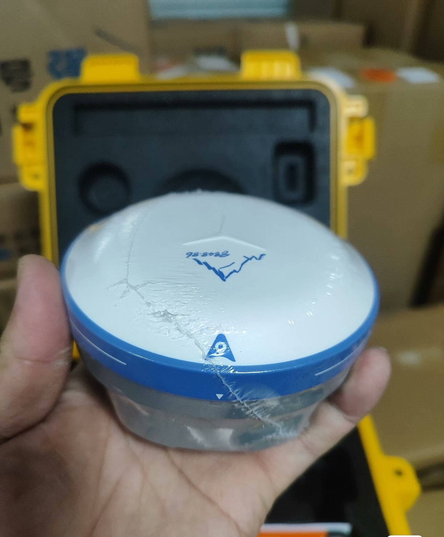
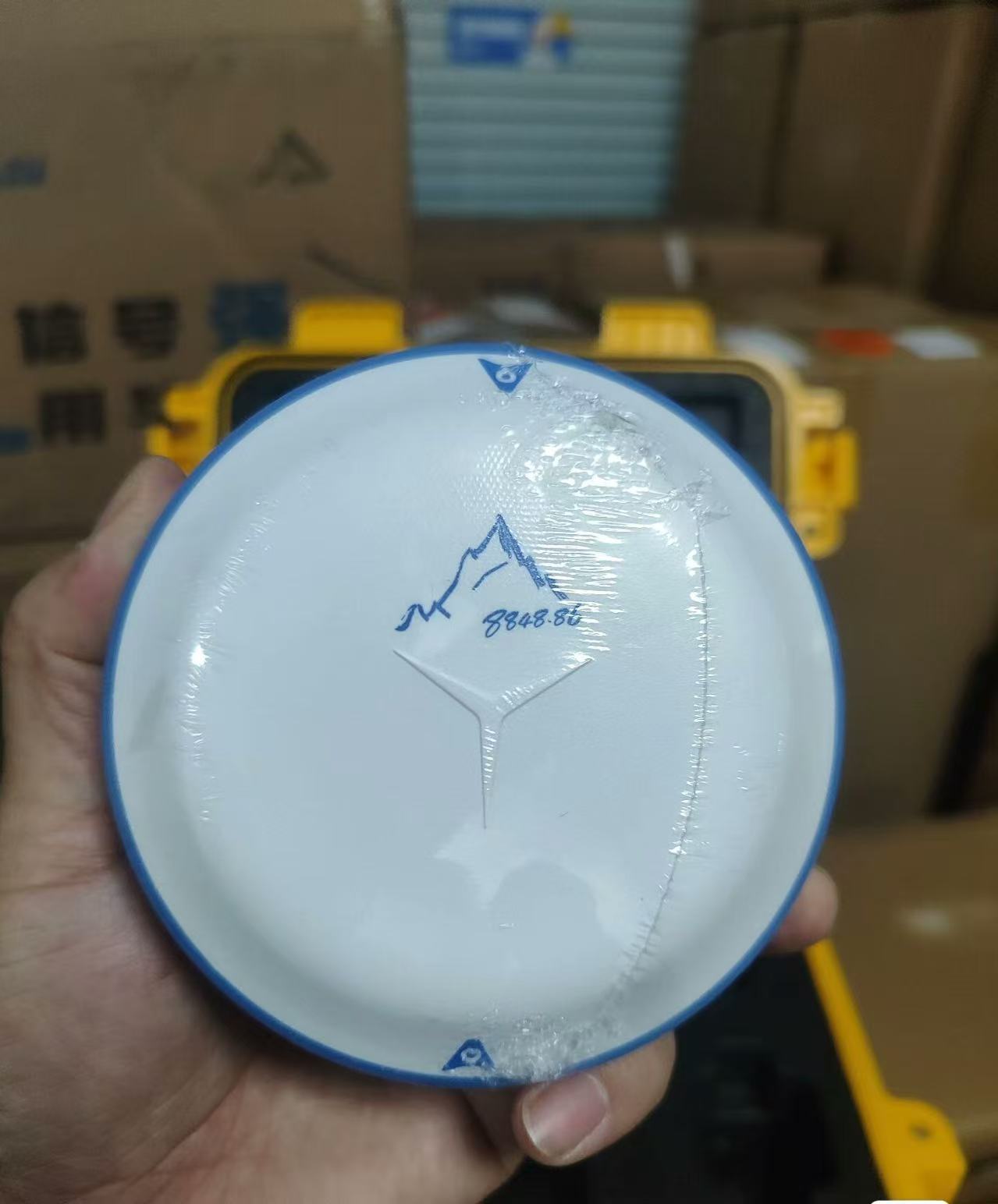
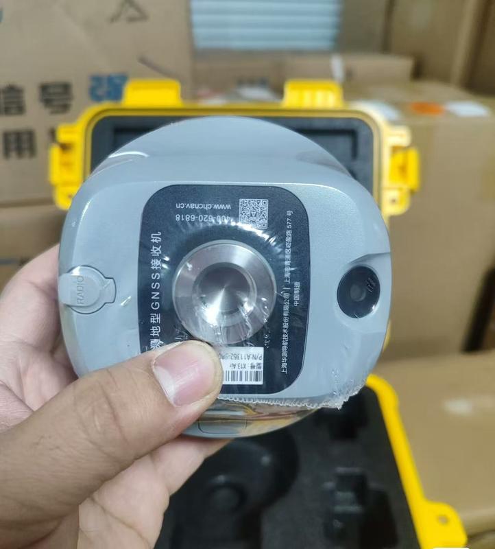
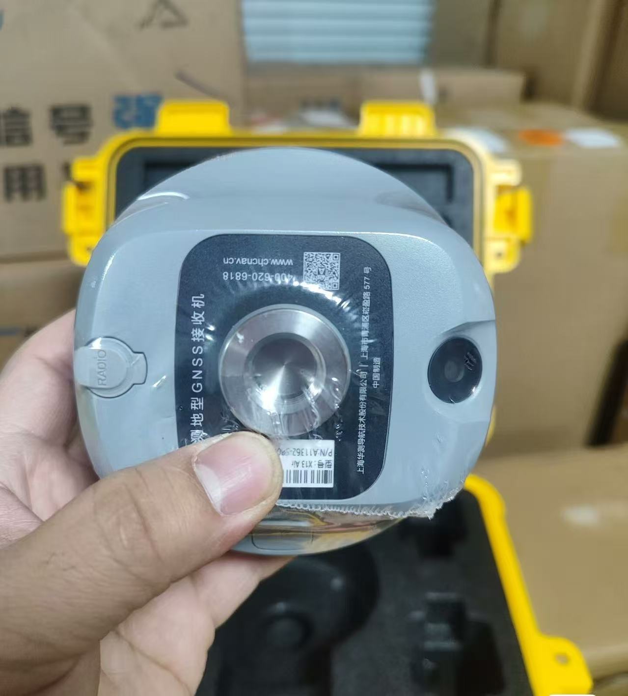
Το i76 Palm Visual RTK είναι ένας ελαφρύς δέκτης που συνδυάζει GNSS, IMU και διπλές κάμερες. Ζυγίζει μόνο 450g και IP68-rated , διατηρεί ένα 96% σταθερό ρυθμό ακόμη και σε περιοχές με υψηλή ηλιακή δραστηριότητα. Το CAD AR visual stakeout επιτρέπει ακριβή σχεδιασμό διαδρομής, ενώ το 5th Gen Ultra-IMU εξασφαλίζει ακρίβεια ακόμη και σε 60° κλίση .
Με πάνω από 17 ώρες διάρκεια ζωής μπαταρίας, το i76 προσφέρει ακρίβεια και προσαρμοστικότητα για επαγγελματίες που αναζητούν ακρίβεια και προσαρμοστικότητα.
Χαρακτηριστικά:
Ενισχύστε την απόδοση της σήμανσής σας κατά 40% χρησιμοποιώντας την τεχνολογία CAD AR visual stakeout. Αυτή η καινοτόμος λύση συνδυάζει βασικούς χάρτες με επαυξημένη πραγματικότητα (AR) για ακριβή σχεδιασμό διαδρομής και οπτικοποίηση σε πραγματικό χρόνο, ενισχύοντας τη συνολική παραγωγικότητα.
Επιτύχετε απαράμιλλη ακρίβεια με την κεραία GNSS αέρα-μέσου 4ης γενιάς και την τεχνολογία iStar 2.0. Το i76 διαθέτει σταθερό ρυθμό RTK άνω του 96% σε περιοχές με υψηλή ηλιακή δραστηριότητα, διασφαλίζοντας την αξιοπιστία της διαδικασίας συλλογής δεδομένων σας.
Βελτιώστε την ακρίβεια μέτρησης κατά 30% με το 5th Gen Ultra-IMU. Αυτό το προηγμένο IMU προσφέρει αυτόματη αντιστάθμιση κλίσης πόλου έως και 60°, εγγυάται ακρίβεια εντός 3 cm χωρίς την ανάγκη χειροκίνητης αρχικοποίησης.
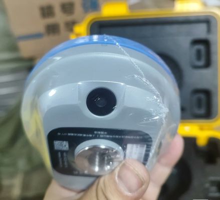
Το i76 είναι ένα ολοκληρωμένο σύστημα που ενσωματώνει GNSS, IMU και διπλές ευρυγώνιες κάμερες, παρέχοντας μια απρόσκοπτη εμπειρία χαρτογράφησης. Επωφεληθείτε από τις δυνατότητες σήμανσης και μέτρησης σε πραγματικό χρόνο με διαισθητική οπτική ανατροφοδότηση για βελτιωμένη ακρίβεια.
Απολαύστε ευκολία και φορητότητα με το i76 μεγέθους παλάμης, που ζυγίζει μόλις 450g. Ο συμπαγής σχεδιασμός του, 40% ελαφρύτερος και 50% μικρότερος από τα βιομηχανικά πρότυπα, διευκολύνει τις εργασίες πεδίου χωρίς συμβιβασμούς στη λειτουργικότητα.
Αντέξτε σε δύσκολα περιβάλλοντα χρησιμοποιώντας την βαθμολογία IP68 του i76 και την αντοχή σε πτώση 2 μέτρων. Η βιομιμητική δομή και ο φακός ζαφειριού εξασφαλίζουν ανθεκτικότητα, καθιστώντας το ιδανική επιλογή για σκληρές συνθήκες πεδίου.
Τεχνικές Παράμετροι:
| Galileo |
E1, E5a, E5b, E5 Alt-BOC |
| GPS |
L1 C/A, L1C, L1P(Y), L2P(Y), L2C, L5 |
| L-band |
Ναι |
| Κανάλια |
226 GNSS Channels |
| IRNSS (NavIC) |
SPS-L5 |
| Στατικό/Γρήγορο Στατικό* |
H: 3 Mm + 0.4 Ppm | V: 5 Mm + 0.5 Ppm |
| QZSS |
L1 C/A, L1C, L2C, L5 |
| BeiDou |
B1, B2 |
| SBAS |
WAAS/EGNOS/MSAS |
| RTK |
H: 5 Mm + 0.5 Ppm | V: 10 Mm + 0.8 Ppm |
Εφαρμογές:
Ο δέκτης CHCNAV i76 GNSS RTK είναι μια συσκευή τοποθέτησης αιχμής που προσφέρει υψηλή ακρίβεια για ένα ευρύ φάσμα εφαρμογών. Με τα προηγμένα χαρακτηριστικά και τον στιβαρό σχεδιασμό του, αυτό το προϊόν είναι ιδανικό για διάφορες βιομηχανίες και σενάρια:
1. Χαρτογράφηση και Χαρτογράφηση: Ο δέκτης CHCNAV i76 GNSS είναι ιδανικός για τοπογράφους και χαρτογράφους που απαιτούν ακριβή δεδομένα τοποθεσίας για χαρτογράφηση εδάφους, ορίων και υποδομών. Οι δυνατότητές του RTK, σε συνδυασμό με τη διπλή συχνότητα BeiDou (B1, B2) και την υποστήριξη IRNSS (NavIC), εξασφαλίζουν ακριβή τοποθέτηση ακόμη και σε δύσκολα περιβάλλοντα.
2. Κατασκευές και Μηχανική: Η υψηλή ακρίβεια του CHCNAV i76 το καθιστά απαραίτητο εργαλείο για επαγγελματίες κατασκευών και μηχανικούς. Είτε για εργασίες σήμανσης, εφαρμογές ελέγχου μηχανημάτων ή παρακολούθηση παραμορφώσεων δομών, αυτός ο δέκτης GNSS παρέχει αξιόπιστα δεδομένα τοποθέτησης για βελτιωμένη απόδοση και ασφάλεια του έργου.
3. Γεωργία και Γεωργία Ακριβείας: Οι αγρότες και οι γεωπόνοι μπορούν να επωφεληθούν από το CHCNAV i76 για πρακτικές γεωργίας ακριβείας. Χρησιμοποιώντας την τεχνολογία RTK και τις ενσωματωμένες δυνατότητες IMU GPS, αυτή η συσκευή επιτρέπει την ακριβή καθοδήγηση για εργασίες φύτευσης, ψεκασμού και συγκομιδής, οδηγώντας σε αυξημένες αποδόσεις καλλιεργειών και εξοικονόμηση κόστους.
4. Κοινωφελείς Υπηρεσίες και Υποδομές: Το CHCNAV i76 είναι κατάλληλο για εταιρείες κοινής ωφέλειας και διαχειριστές υποδομών που απαιτούν ακριβή χαρτογράφηση περιουσιακών στοιχείων και συντήρηση. Η πιστοποίησή του CE, η μπαταρία Li-ion μεγάλης διάρκειας και η ενσωματωμένη τεχνολογία Full Wave Fence Antenna™ εξασφαλίζουν αξιόπιστη απόδοση σε διάφορα περιβάλλοντα εργασίας.
5. Περιβαλλοντική Παρακολούθηση: Οι ερευνητές και οι περιβαλλοντολόγοι μπορούν να αξιοποιήσουν τον δέκτη CHCNAV i76 GNSS για την παρακολούθηση των οικοτόπων της άγριας ζωής, την παρακολούθηση της κλιματικής αλλαγής και τη διεξαγωγή γεωχωρικών μελετών. Η υψηλή κάθετη και οριζόντια ακρίβεια της συσκευής, σε συνδυασμό με την ανθεκτική κατασκευή της, την καθιστούν ένα ανεκτίμητο εργαλείο για τις προσπάθειες διατήρησης του περιβάλλοντος.
Με ελάχιστη ποσότητα παραγγελίας 1 και τιμή 1480USD, το CHCNAV i76 προσφέρει εξαιρετική αξία για τα προηγμένα χαρακτηριστικά και την αξιόπιστη απόδοσή του. Οι όροι πληρωμής 100% T/T διευκολύνουν τους πελάτες να αποκτήσουν αυτόν τον κορυφαίο δέκτη GNSS RTK από την Κίνα. Είτε για επαγγελματική χαρτογράφηση, γεωργία ακριβείας, κατασκευαστικά έργα ή επιστημονική έρευνα, το CHCNAV i76 είναι μια ευέλικτη και αξιόπιστη λύση για απαιτητικές εφαρμογές.

 Το μήνυμά σας πρέπει να αποτελείται από 20-3.000 χαρακτήρες!